El Suez Governorate | Suez Canal Egypt
Suez Canal Egypt
Suez Governorate is one of Egypt's governorates, with an area of 25,400 km2. Its capital is the city of Suez. It is an urban governorate with one city, characterised by a unique location as it is the entrance to Africa and the countries of Southwest and East Asia, which made it a meeting place for global trade and a citadel for industry and industrial investment.
Suez is one of the richest countries in Egypt with a tourist attraction where the average number of visitors annually is more than 256.972 thousand visitors annually, due to its natural beauty as it is embraced by Mount Ataqa to the west, the Gulf of Suez and the Abu Al Daraj lighthouse to the south, the Suez Canal to the east, parks, Geneva and lakes to the north, which distinguishes it from others with a wonderful atmosphere all year round.
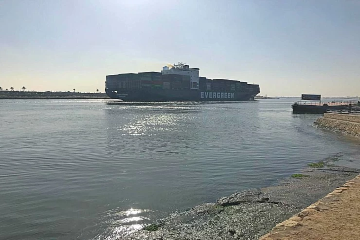
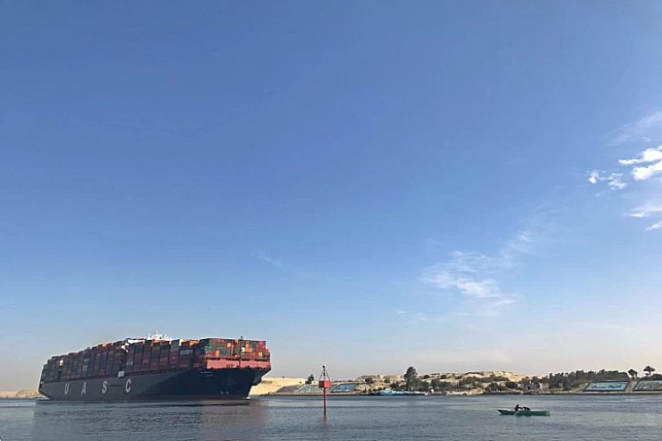
The Suez Canal is a man-made waterway at sea level that stretches across Egypt from north to south through the Isthmus of Suez to link the Mediterranean with the Red Sea. The Canal also separates the two continents of Africa and Asia. It is the fastest maritime route connecting Europe with the nations west of the Pacific and around the Indian Ocean. It is among the world's busiest waterways.
The characteristics of the canal
The canal crosses four different zones from north to south. From Port-Saïd, built on a sandy ridge, it crosses 40 km of flooded land bordering Lake Manzala. It then crosses a region of sills, enters Lake Timsah, on the shores of which the town of Ismā'īliya was built, and reaches the depression of the Amers Lakes. It follows the communicating basins of these two lakes, which were once parched. Finally, for 25 km, it skirts the rocky foothills that separate the Nile basin from the Red Sea, and reaches the Gulf of Suez at Port-Tawfīq, 3.5 km south of the Arab city of Suez.
The total length of this canal at level (i.e. without locks) is 164 km. When it was commissioned in 1869, it was between 7 and 8 metres deep, which was enough to allow the large ships of the day to pass through, and around 20 metres wide, which meant it had to be crossed at stations.
The rapid increase in the number, tonnage and speed of ships passing through the canal led the managing company to carry out numerous works to adapt the canal to the new requirements: increasing the depth and, above all, the width of the waterway to allow ships to pass at any point, consolidating the embankments and modifying their profiles, and developing the port facilities.
Between commissioning and 1948, six improvement programmes brought the minimum width of the canal to 60 m, and its depth to 11.70 m (allowing the passage of ferries with a draught of 10.36 m). Despite these changes, the appearance of very large ships - particularly oil tankers - soon necessitated the formation of convoys crossing each other in the Amers lakes. To speed up transits, the seventh programme provided for another crossing zone: a branch canal doubling the main canal between kilometres 50 and 60 (from Port-Saïd); it was brought into service in 1951.
Suez Governorate
Suez Governorate is one of the governorates of the Arab Republic of Egypt, which is located within the territory of the Suez Canal, which also includes the governorates of Port Said and Ismailia, and the Suez Governorate has been divided administratively into five regions, namely: Suez, Forty, Ataqa, Faisal,
and Al-Janayen, and these areas are approximately 728,180 people. According to the statistics of 2018, the emblem of the Suez Governorate is represented by the presence of a shape in the form of a wheel or a toothed gear about the strength of the industrial sector in the governorate.
and in the middle of the wheel is a red flame, an indication that the Suez Governorate is a major headquarters for the petroleum industries and several companies in petroleum in the Egyptian Republic.
Suez Governorate is characterized by its vital tourism sector, as it is visited by approximately 256,972 visitors every year due to the presence of a group of stunning landscapes, such as Mount Ataka located in the west, Fanar Abu Al Daraj in the south, the Gulf of Suez, the Suez Canal in the east, lakes, and parks in the north.
The following are the most prominent tourist attractions in Suez:
Ain Sokhna:
Ain Sokhna resort is located on the Red Sea coast on the Swiss Bay, about an hour's drive from the city of Cairo, it has sulfur hot springs coming from the desert mountain of Ataka, and it represents an important international tourist destination and destination.
Moses fountains:
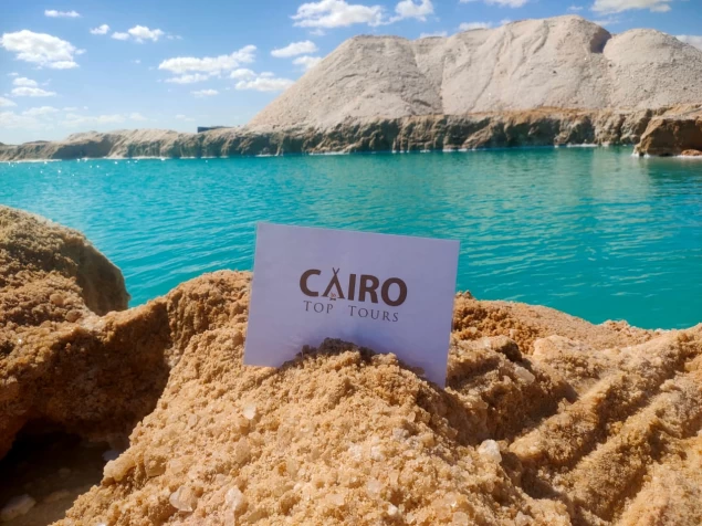
Moses fountains are about 25.74 km from the south of the Ahmed Hamdi tunnel, which has 12 springs, 7 of which are still operating to this day. This oasis represented the largest oasis in the Sinai during the nineteenth century AD, and some communities appeared in the area around these springs.
The northernmost part of the Red Sea is divided into two Gulfs in the Sinai Peninsula: the Gulf of Aqaba in the east and the Gulf of Suez in the western corner. From the strait of mountains to the Egyptian city of Suez, with a distance of 314 km (195 miles), the width of the Gulf ranges between 19-32 km, and the Suez Canal operates as an important shipping route between the Gulf of Suez and the Mediterranean.
Suez governorate flag
in the middle of the wheel is a red flame, an indication that the Suez Governorate is a major headquarters for the petroleum industries and several companies in petroleum in the Egyptian Republic.
Suez Governorate is characterized by its vital tourism sector
Suez Governorate is characterized by its vital tourism sector, as it is visited by approximately 256,972 visitors every year due to the presence of a group of stunning landscapes, such as Mount Ataka located in the west, Fanar Abu Al Daraj in the south, the Gulf of Suez, the Suez Canal in the east, lakes, and parks in the north.
The following are the most prominent tourist attractions in Suez:
Ain sokhna egypt
Ain Sokhna resort is located on the Red Sea coast on the Swiss Bay, about an hour's drive from the city of Cairo, it has sulfur hot springs coming from the desert mountain of Ataka, and it represents an important international tourist destination and destination.
Moses fountains
Moses fountains are about 25.74 km from the south of the Ahmed Hamdi tunnel, which has 12 springs, 7 of which are still operating to this day. This oasis represented the largest oasis in the Sinai during the nineteenth century AD, and some communities appeared in the area around these springs.