Cairo Top Tours
Cairo Top Tours

Latest Articles

  • See Nile River Tourist Attractions

    Best Things to Do in Nile River

    The Nile’s tourism potential is excessive; from southern Egypt and all the way to the northern regions, The Nile River makes some of the most pleasant tourist places in Cairo on the Nile, for Egyptian dwellers and even the visitors, who traveled to Egypt for the pleasures of the country and people.

  • The Monastery of El Suryan

    The Monastery of El Suryan | Deir Al-Surian Cairo Attractions

    The Monastery of the Virgin Mary the Syrian is considered one of the oldest monasteries in the history of the church, dating back to approximately the fifth century AD, as various sources indicate. The old fortress is located to the right of the entrance to the monastery, although it has been restored.

  • 10 Most Popular Egyptian Dishes

    Traditional Egyptian food

    Each Arab country has its own character, and Egypt is one of the most famous countries for food. Egyptians are known for their love of food, so they excelled in making dishes and inventing new things. The most famous Egyptian dishes are falafel, koshari, stuffed vegetables of all kinds, and molokhia.

  • Dolphin House Reef

    Dolphin House Marsa Allam

    Wadi El Gemal Nature Reserve in Marsa Alam is taking several measures to preserve the lives of Red Sea dolphins, which are a national treasure and a source of attraction and tourist income for diving and snorkeling, and to generate financial income for the state by collecting visit fees.

  • Tanis The Ancient City of Egypt

    Tanis: The Lost City of the Pharaohs

    In the northeast of the Nile Delta in the Sharqia Governorate, about 150 km from Cairo, lies the city of “Tanis”, which is currently known as the city of “San El-Hagar”, that historical city or unknown capital that was founded on the banks of the Nile thousands of years ago, and was also known as “Ga’net” and “Sa’an”.

  • Tel Basta museum - Egypt

    Tell Basta Museum in Al-Sharqiyah

    An ancient site called Tell Basta is located outside of Zagazig in the Sharqia Governorate. It was one of the ancient Egyptian capitals and a significant place of worship. In the Old Kingdom, it served as the capital of the 18th province. During the 22nd Dynasty, it was the capital of every province. In the past, it was referred to as "Per-Bastet" in honour of "Bastet," the god of comfort, joy, and happiness. Later, "Tell Basta" was used instead.

darb el-arbain caravan route

Details about Darb al arbain

  • 05 16, 2023

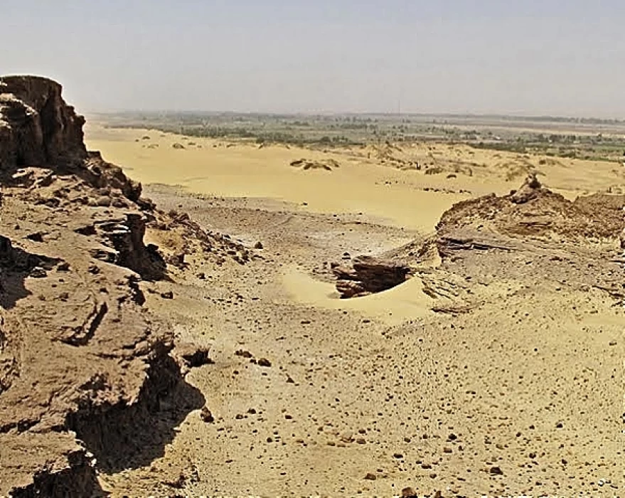
The desert route of Darbel Arbain

The “Arbaeen Trail” is a road known since ancient times as the Western Mountain, as caravans used to travel the distance from Sudan south to the Nile Valley through Assiut in about forty nights. This trail was a vital artery for land trade between Egyptian countries on the one hand, and between Sudan and northern Maghreb countries on the other hand, in addition to the passage of pilgrimage caravans, which made Assiut acquire an important strategic location and became the commercial capital of Upper Egypt.

Assiut's western mountain, the Western Plateau, includes the most important ancient caravan routes linking Egypt with Sudan (Darfur and Kordofan) via the Arbaeen Trail, and this road had a great impact on Assiut's history and its importance in terms of trade and industry, and in the Pharaonic, Greek and Roman eras due to its association with this road.

The road gained its importance in ancient Egypt due to its intermediate location between the regions of Pharaonic Egypt and being a major center for commercial caravans heading to the oases in the Western Desert, and the beginning was from Darb al-Arbaeen, which connects Darfur to Sudan, where it is located at the head of the caravans that connect the Nile Valley with the oasis of Kharga and Darfur in western Sudan, which is considered the trade route between the two parts of the Nile Valley and the continent of Africa.

The road includes in a large part of it within the Egyptian borders currently the distance between Assiut and the city of Kharga, and from there it heads south, passing through the town of Paris and Jebel Sharsher to Bir Karim, this distance amounts to about 380 kilometers, and a large number of drinking water wells are located on this road, the most famous of which are Bir Murr, Abu Al-Hussein and Kseiba well.

The caravans coming from Darfur, Kordofan, the Takrour countries and Morocco also used this route, whether on their trade trips or on the annual pilgrimage, landing several times during their travels near water sources to take a rest, and their most important stops on this arduous journey were the village of Kharga, specifically on the height of Jebel al-Tair “Al-Bajwat” and after the commercial caravans from it had paid the estimated fees to the oasis scout in the village of Paris, if the caravan was not allowed to continue its journey north towards Cairo until it had paid its fees in full.

A commercial caravan from Morocco used to arrive in Egypt every year in addition to the two caravans from Sudan, the “Sennar” caravan, which used to reach Upper Upper Upper Egypt via Wadi Halfa and Aswan, and the Darfur caravan, which reaches Central Upper Egypt via the Darb al-Arbaeen road to Kharga and from there to Assiut, and Escafrack, a French traveler, followed the trade on this route However, this trade declined immediately after the years of the British occupation of Egypt and England's attempts to interfere in Sudan's affairs and distance it commercially and politically from Egypt, and to tighten control over the Egyptian borders in order to isolate the Mahdist dervishes in Sudan and eliminate the Mahdist revolution.

Tags:
Share On Social Media:

Egypt Tours FAQ

Read top Egypt tours FAQs

Darb al-Arba'in" is an Arabic term that translates to "The Forty Days Road" in English. It refers to an ancient trade route and caravan trail that traversed the deserts of Egypt and connected various regions of North Africa. This route played a significant role in facilitating trade, commerce, and cultural exchange across the region.

The Darb al-Arba'in route extended for approximately 1,200 kilometers (746 miles) through the Egyptian desert, connecting the Nile River Valley with areas in the Western Desert, such as the oases of Bahariya, Farafra, Dakhla, and Kharga. It then continued southwestward, leading to the Gilf Kebir plateau and eventually reaching the Sudanese border.

Key points and oases along the Darb al-Arba'in included:

   Bahariya Oasis: This oasis served as an essential stopover point for caravans traveling along the route. It provided a source of water, food, and shelter for travelers.

   Farafra Oasis: Located to the southwest of Bahariya, Farafra was another crucial oasis along the route, offering resources to caravans and travelers.

   Dakhla Oasis: Further along the trail, Dakhla Oasis was an important oasis town known for its rich history and archaeological sites. It provided a place for rest and resupply.

   Kharga Oasis: Kharga was the largest oasis on the Darb al-Arba'in route, and it played a vital role in supporting caravans and travelers. It was known for its agriculture and fortifications.

   Gilf Kebir: The Darb al-Arba'in extended to the remote Gilf Kebir plateau, which is famous for its striking landscapes and prehistoric rock art.

The Darb al-Arba'in route was historically used for trade in goods such as salt, gold, precious stones, and other commodities. It was also a route for cultural exchange and communication between various regions of North Africa.

;

Cairo Top Tours Partners

Check out our partners

EgyptAir
Fairmont
Sonesta
the oberoi