Safaga Port Egypt
Location and routes
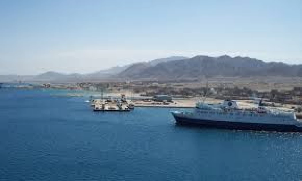
The mining port of Safaga is located on the coastal strip of the Red Sea south of the city of Safaga (kilometer "3.3 – 4.6" Safaga – short road), 65 km from Hurghada and about 6 km south of the seaport of Safaga
Coordinates:
33 o 57th meridian east
26 o 44 / north latitude circle
Natural Properties
The location is characterized by a stable dry climate throughout the year that does not adversely affect maritime navigation or various activities.
Weather north-west and south-east winds
Relative water density 1.04 g / cm3 rainy seasonwinter
The amount of tides (in meters) from 1.2 to 2.1 meters
Navigational guidance
It is carried out by the Red Sea Ports Authority through the naval units located at the Safaga commercial maritime port next to us.
Map of navigational characteristics
Characteristics of the Bogaz and the navigational path (the submersible is 15 meters).
Land areas allocated to the port
The total land area of the lands allocated to the port is about 636,450 M2
A plot of land surrounded by a fence of buildings with an actual area of up to 360,450 M2 a plot of space for expansions surrounded by a barbed wire fence with an area of about 252,000 m2 an outdoor space plot surrounded by a barbed wire fence with an area of 24,000 M2 the Marine Area of the pier is about 15,600 M2
Port map
The main units of the existing dry casting plant :
Phosphate ore truck unloading station.
The main warehouse for the formation of phosphate ore with dimensions of 50×230 meters with a capacity of 100 thousand tons is equipped with conveyor belts, an upper molding and stacking unit for ore in The Stacker warehouse, as well as a recovery and shipment unit for ore from the Scraper warehouse with a capacity of 1500 tons/hour. The storage can be shipped with two different phosphate ores, provided that a distance ( one pack ) is left between them without ore without erecting a separation wall between them and within the design capacity limits
Several closed stores and barbecue areas for customers.
A 100-meter-wide service area between the units is dedicated to the conveyor belt group between the roasting warehouses and the export Wharf with an operational length of 1.5 km and a capacity of 1500 tons/hour with accessories from a magnetic separation unit for metal impurities, electronic scales on the belts and diversion towers for the tracks of transported ore with their equipment.
A marine export pier extended at sea 135 meters away from the shore and then extends 60 meters wide with a length of 260 meters and a depth of 14 m allows receiving ships up to a load of 65 thousand tons and is equipped from both sides with additional mooring candles “dolphin” with an additional length of 70 meters, the pier is equipped with a rear Chuen area for various cargoes, and the pier is connected to the port by a bridge in the northern part and two car bridges in the southern part.
The ship loader ore loading equipment at the export terminal with a capacity of 1500 t/h is movable on rails and equipped with an environmentally compatible telescopic cargo unit.
120-ton Electronic Balance for trucks to serve companies and control overloads
The operation, control, and performance monitoring station of the Loading, Unloading, and handling system using the latest specialized computer programs in this regard SCADA from inside an independent building next to the system, in addition to the local operation capabilities next to each unit (unloading station– main store – cargo winch at the pier), by a specialized team of engineers, technicians and workers with a high degree of efficiency, training, and excellence to accomplish unloading, loading, maintenance, monitoring rates and following up routine procedures throughout the day during the week during the year (24/7/12).
Port facilities and service units
Administrative building
Police and fire building
Maintenance workshop building
4 main electrical transformer stations distributed inside the port
A 100-cubic-meter freshwater ground tank and a pump station for feeding fresh water to Port, Quay, and ship units
A socket on the pier to provide ships with electric power when needed
A telephone communication network to connect all port units.
The network of connecting cables between terminals and various units.
A network of cables for feeding equipment with a voltage of 11k.P and feeding belts with a voltage of 380 V.
Parking canopy
Guard towers and security on fences and Gates
A break for port workers “outside the port”
Lakes, channels, and dams “outside the port between the mountains” absorb the waters of possible floods in order to raise the degree of protection of the port and protect investments.
Navigational signs for the two areas of approach to the port of Safaga include:
Radio surveillance system
Accompanying naval vessels (belonging to the Safaga Seaport)
Latest Articles
Admin
Regin of Abbas I of Egypt | Abbas Pasha I
Abbas has been often described as a mere voluptuary, but Nubar Pasha spoke of him as a true gentleman of the "old school". He was seen as reactionary, morose and taciturn, and spent nearly all his time in his palace. He undid, as far as lay in his power, the works of his grandfather, both good and bad.
Admin
Biography of Tewfik Pasha/ Tawfiq of Egypt
Muḥammad Tawfīq Pasha (born April 30, 1852, Cairo, Egypt—died Jan. 7, 1892, Ḥulwān) was the khedive of Egypt (1879–92) during the first phase of the British occupation. The eldest son of Khedive Ismāʿīl, Tawfīq, was distinguished from other members of his family by having engaged in study in Egypt rather than in Europe
Admin
Story of Gabal Shayeb Al Banat - Red Sea Mountain
Jabal shayb al-banat is one of the Red Sea Mountains in the eastern desert in Egypt, located to the west of the city of Hurghada at a latitude of 27 degrees north and a longitude of 33.5 degrees east of the Greenwich line approximately, this mountain is the highest mountain peak in the eastern desert with a height of up to 2185 meters, it is a prominent mass of igneous rocks
Admin
Neper God Of Grain
Neper was the deity of grains, particularly cereals that were important in Ancient Egypt, such as wheat and barley. It was stated that he foretold when the crops would grow, be harvested, and disappear.
Admin
Badr Museum in Farafra
The Badr Museum is located in a mud building, which is the common home found in this medieval part of Egypt. All of the artwork that was created by the artist is quite unique. His work almost always depicts life in the Farafra Oasis and he provides the work through both painting and sculpting.
Admin
The Black Head Temple
The Black Head Temple is a small temple dedicated to the worship of the goddess Isis and was discovered in 1936, by chance, in the Black Head area, which is now located within the Mandara area of the Montazah district in Alexandria. This temple was moved from its original place to the Latin Necropolis in 1994.

-webp.webp)
