Al Fayoum City
During the reign of the Pharaohs, Fayum was part of the twenty districts of the provinces of the tribal face and was the capital of ahnasia, and when it flourished, its name became barseen, i.e. the House of the crocodile, which was worshiped at that time, and it also has a rural, coastal, desert and urban environment – so Fayum is considered one of the tourist attractions in Egypt.the name came in the late texts of the Pharaonic era bayum meaning lake or water, then it was mentioned in Coptic Fayum and in Arabic Fayum after the introduction of the identification tool.
Kaman Fars is the remains of the ancient city of shedet, which means reclaimed, which is the name of the ancient Fayum in pharaonic times, Fayum has more than one name such as "Ta-Shi", which means the land of the lake,"Mer-or" means the Great Sea, then "arsenoy", which is the queen wife of Ptolemy II, then "crocodilopolis", which means the city of the crocodile, because the crocodile is the main God of Fayum.
And then finally "bayum", which was transliterated to Fayum, but Kaman fares is the current common name for this city and this area has archaeological remains such as the remains of the temple of Ramses II and part of a wall for the remains of a Greek temple, perhaps for Ptolemy II, then Roman baths and modern buildings are currently Fayum University, Housing, and government interests.
Agriculture,
It is the first economic activity in the governorate and among the most productive crops are wheat, corn, tomatoes, sugar beets, mangoes, figs, and dates.
Commerce,
It is concentrated in the city of Fayoum and is concentrated in the downtown areas and includes clothing, electronics, mobile phones, and food.
Fishing,
This is due to the spread of waterways, Lake Qarun and Wadi Al-Rayyan.
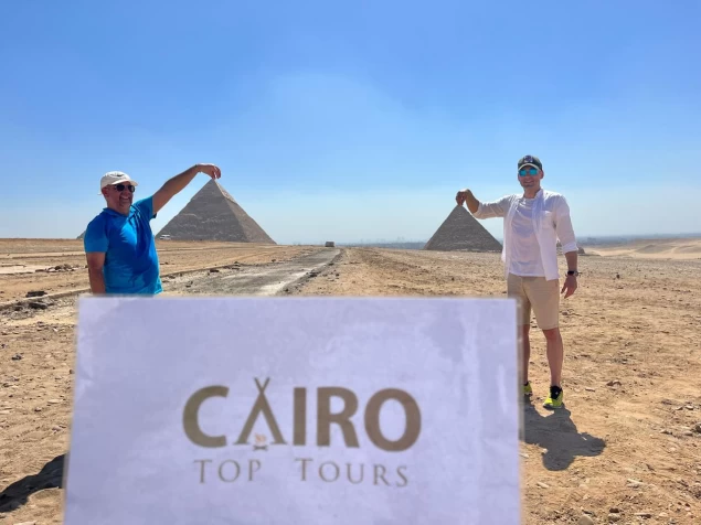
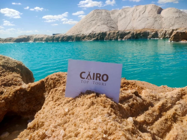
Fayoum governorate is one of the governorates of Egypt, its capital is the city of Fayoum, and represents the largest natural oasis in Egypt. The desert surrounds the governorate from every side except its southeast, which connects to the Beni Suef governorate. Fayoum is famous for the presence of many natural places, the most famous of which are Lake Qarun Reserve, Wadi Al-Rayyan Reserve, Wadi el-Hitan Reserve registered as a World Heritage site, besides its mild climate and its location close to the Egyptian capital Cairo, as well as a variety of pharaonic, Roman, Coptic and Islamic monuments, which qualified it to be one of the Egyptian tourist attractions. The governorate celebrates its national day on March 15 every year, in memory of the stand of the Fayoum people against the English occupation during the 1919 Revolution led by Hamad Pasha al-Bassil.
Origin of the name,
The rumors differed about the origin of the name" Fayum", most likely it was once called" Chdat or Chedit", meaning the island, because at the time of its formation, it was located in Lake Maurice," Lake Qarun now", and its religious name was" Per Sebek", meaning the House of the crocodile, because it was the idol of the people of Fayum in ancient times, and that's why the Romans called it" Crocodilopolis", meaning the city of the crocodile. In the early Ptolemaic rule, Ptolemy II philadef named it "Arsinoe" after his wife arsenoe, and the territory was also named by this name, and then the Copts called it "Piom", meaning the base of the lake country, because the word "Piom", which was later known as "Phiom", consists of two words, namely "Pi" and indicates the place and definition, and the word "Im", meaning Yum, lake or sea, and from "Phiom" the Arabs took the word "Fayum", and added to it the identification tool, so it became "Fayum" is her Arabic name. Another opinion says that its name came in the late texts of the Pharaonic era "byom" meaning lake or water, then it was mentioned in Coptic as "Fayum", and with the spread of Arabic, the identification tool was added to it, so "Fayum" became its Arabic name. The governorate is called "Little Egypt" due to its miniature geographical picture of the Egyptian country, where the sea of Joseph for Fayoum is similar to the Nile River for Egypt and Lake Qarun is similar to its northern coast and represents the Mediterranean Sea for Egypt. Some weak legends attribute the name to the reign of the Prophet Joseph because of the time it took to build the city, estimated at "a thousand days".
History,
During the Pharaonic era, Fayoum was part of the twentieth province of the tribal face, whose capital was ihnasia - one of the Centers of the present-day Beni Suef governorate -, and it was considered a fishing center centered on Lake Morris-Lake Qarun currently -. With the entry of the Ptolemaic era, the city of Kranis was established, which is located to the north of the current city of Fayum and to the east of Lake Qarun, which continued to flourish until the Roman era and then deteriorated with the end of the third century AD and the beginning of the fourth century, the reason for its establishment was the settlement of Greek immigrants and was an agricultural area since the Ptolemaic era until the Roman era. Historians disagree about the date of the campaign sent by Amr ibn al-as to conquer the Fayum territory, some of them believe that in June 640 he sent a squad to attack Fayum during his siege of the Babylonian fortress, while the other team believes that the Muslims did not hear about Fayum until a year after they entered Egypt and after the fall of the Babylonian fortress, until some Egyptians pointed them out to them. During the modern era, the Fayoum people participated in standing up against the English occupation during the 1919 Revolution led by Hamad Pasha al-Bassil, and the day of their revolution on the fifteenth of March was considered a national holiday of the province.
Geography and population,
The governorate is the largest natural oasis in Egypt, as it represents a deep depression in the limestone plateau of the western desert, and it is surrounded by the desert on all sides except the southeast, where it connects to Beni Suef governorate, and follows the Northern Upper Egypt region at a distance of 92 km southwest of Cairo governorate. The total area of the governorate is 6068.70 km2, and lakes, eyes, greenery, and desert meet on its land to represent a diverse natural picture besides its temperate climate throughout the year. The lands of Fayoum are not flat, but they are gradually sloping from south to North in the form of successive terraces, the land is more flat towards the East and sloping towards the northwest in three main levels:
The first runway: from the Lahun aqueducts to the city of Fayoum (+5.22 m)
The second runway: from the city of Fayoum to the village of Senhor (- 10 m)
The third runway: from Senhor to Shakshuk to the coast of Lake Qarun (- 43m).
This depression is similar to the lowlands of the western desert, where most of its parts are below sea level, and it is considered an area with internal drainage, but it differs from it in its connection with the Nile River through the soil of the sea of Youssef, which covered its territory with Abyssinian silt, and therefore it is considered part of the Nile Valley. This depression was created as a result of geological evolution over time, which was formed by air erosion and other natural factors, both internal and superficial. The Eocene layers mostly disappear under the following more recent formations, which include (Oligocene, Miocene, Pliocene, and Pleistocene) and are located either outside the depression, on its sides, or inside it, while the Eocene layers appear on the edges of the depression in a striking annular distribution of layers of huge terrestrial and coastal vertebrate animal remains, such as whales, crocodiles, turtles and sea snails, which indicates an ancient river that was represented by the stratigraphy traces of some plants The old ones. In the Oligocene sedimentary layers, there are remains of fallen trees and large land animals such as Arsenotherium, crocodiles, and turtles, all of which indicate a marine environment that existed at the Fayum site.
Population,
In 2014 the population of the governorate was about 3,115,000. Fayoum society is characterized by a multiplicity of cultural features, it is divided into a nomadic and a rural community, each of which has its traditions, customs, and culture.
Tourism,
One-day tourism is one of the main activities of the governorate, where the tourist, environmental, archaeological, and climatic components of the region represent an effective attraction factor for places such as Wadi Al-Rayyan Reserve and Lake Qarun, with which expats practice sand skiing sports, parachuting, land "parachute" and boat trips in Lake Qarun, in addition to visiting the village of Tunis. These activities are sponsored by the governorate's Tourism Promotion Authority. The Fayoum Civilization and Heritage Center, in cooperation with the Faculty of Tourism and Hotels at Fayoum University and the Ministry of Tourism, organizes some programs to encourage tourism in the governorate. The area is also a popular destination for migratory bird hunters.
Agriculture,
The agricultural area of the governorate is 434.6 thousand acres and is famous for growing fruits, mainly grapes and figs. All traditional crops are also grown there, the most famous of which are wheat, cotton, rice, sorghum, sugar beet, and sunflower.
Fish farms,
Fayoum governorate has a vast area of water bodies represented by both Lake Qarun and Al Rayyan reservoirs, which together amount to about 90 thousand acres and represent an important source of the main sources of fish wealth in Egypt. In addition to the private fish farms that exploit wastelands unsuitable for agriculture, these projects began with 2 farms with an area of 19 acres in 1984 until it reached 209 with an estimated area of 2496.15 acres until the end of 2010, distributed among fish farms, fish cages, and natural pastures. This is under the supervision of the General Authority for the Development of Fisheries.
Petroleum,
The detection of crude oil in the governorate is led by Qarun Petroleum Company, which, in partnership with foreign companies and under the supervision of the Egyptian General Petroleum Authority, extracts oil from several wells in various fields in various parts of the governorate, perhaps the most famous of which are the areas of Wadi Al-Rayyan, Lake Qarun and the village of sila. Drilling operations in these areas are carried out in an economical manner that does not require heavy equipment or large areas, taking into account environmental requirements.
Industry,
There are two industrial zones in Fayoum, namely Al-Fath Industrial City in Kom osheim, located on an area of 1102 acres, and the second with its strong point, located on an area of 2000 acres. the two areas include several projects engaged in the production of sunflower oil, ceramics, refrigerators, nail industry, and paints. In addition, industries are operating outside the industrial zones in the fields of cotton spinning, feed processing, ceramics, pottery, beet sugar, lime, and carpet industries.
Handicrafts,
Handicrafts in the governorate are one of the important sources of income for its citizens, especially (handmade carpets, baskets, and dobar industry, and food drying industry) and the state encouraged this industry by establishing the craft center or handicrafts Center in Ain Al-silayeen at a total cost of 3,360,000 pounds. The center aims to showcase and revive local handmade products, revive traditional crafts, provide artisans with the opportunity to develop their workshops, and increase the income of families working in these crafts.
Latest Articles

Admin
Neper God Of Grain
Neper was the deity of grains, particularly cereals that were important in Ancient Egypt, such as wheat and barley. It was stated that he foretold when the crops would grow, be harvested, and disappear.

Admin
Djoser
Djoser was an ancient Egyptian pharaoh of the 3rd Dynasty during the Old Kingdom and was the founder of that epoch. He is also known by his Hellenized names Tosorthros (from Manetho) and Sesorthos (from Eusebius). He was the son of King Khasekhemwy and Queen Nimaathap, but whether he was also the direct successor to their throne is unclear. Most Ramesside king lists identify a king named Nebka as preceding him, but there are difficulties in connecting that name with contemporary Horus names, so some Egyptologists question the received throne sequence. Djoser is known for his step pyramid, which is the earliest colossal stone building in ancient Egypt

Admin
Kom Al Dikka Alexandria
Kom El Deka, also known as Kom el-Dikka, is a neighborhood and archaeological site in Alexandria, Egypt. Early Kom El-Dikka was a well-off residential area, and later it was a major civic center in Alexandria, with a bath complex (thermae), auditoria (lecture halls), and a theatre.

Admin
The God Anuket
Anuket, in Egyptian religion, the patron deity of the Nile River. Anuket is normally depicted as a beautiful woman wearing a crown of reeds and ostrich feathers and accompanied by a gazelle.

Admin
The Red Chapel of Hatshepsut
The Red Chapel of Hatshepsut or the Chapelle rouge was a religious shrine in Ancient Egypt. The chapel was originally constructed as a barque shrine during the reign of Hatshepsut. She was the fifth pharaoh of the Eighteenth Dynasty from approximately 1479 to 1458 BC.

Admin
The Serapeum of Alexandria
The Serapeum of Alexandria in the Ptolemaic Kingdom was an ancient Greek temple built by Ptolemy III Euergetes (reigned 246–222 BC) and dedicated to Serapis, who was made the protector of Alexandria, Egypt. There are also signs of Harpocrates. It has been referred to as the daughter of the Library of Alexandria.