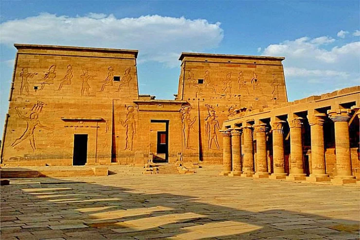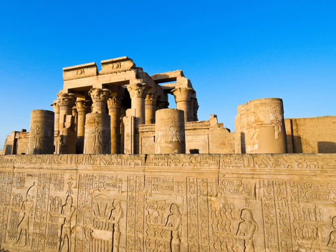
Luxor Governorate Egypt
Luxor governorate is an Egyptian governorate located in the southern Upper Egypt region, its centers and cities are distributed on both banks of the Nile River, and its capital is the city of Luxor, which was the ancient city of Thebes, the capital of Egypt during several pharaonic eras. The governorate was established in accordance with Republican Decree No. 378 of 2009 issued on December 9, 2009. The governorate has a rare collection of archaeological places, many of which are still preserved in their condition, the most famous of which are: Luxor Temple, Karnak temples, tombs of the valley of Kings, Valley of Queens, funerary temples, Esna temple and others, next to the unique artifacts displayed by the Luxor Museum. The capital of the province (Thebes) remained the capital of Egypt until the beginning of the sixth Pharaonic dynasty, when the capital moved to MANF in the North.
The most famous of them were the city of the hundred Gates, the city of the sun, the city of light, the city of the scepter "wast", and the Arabs called it "Luxor" for its many palaces and "temples". Luxor attracts a large segment of incoming tourism to Egypt, because of its human heritage that has contributed significantly to linking the present with the ancient Egyptian civilization and was chosen as the capital of World Tourism for 2016, and the capital of Arab culture in 2017. The national day of the governorate was the day of the decision to establish it on December 9, until May 20, 2015, when the Council of Ministers approved the amendment of the date of celebrating the national day of the governorate to November 4 of each year, the day that marks the anniversary of the discovery of the Tomb of Tutankhamen.
The governorate is located on an area of 2959.6 km2 between latitudes 36-25 North, and 33-32 East, and is administratively divided into Luxor city, bayadiyah Center, Quran Center, Arment center, Al-Tod Center, Esna Center, New Luxor City, New Thebes city, bordered to the north by Qena governorate, south by Aswan governorate, East by Red Sea governorate and West by New Valley governorate.
History
Luxor governorate, with its current organization, is a close reflection of the fourth region of the ancient upper Egypt, which was called the "Wast" or "scepter" region, the same name as the capital, which included the city of the living on the right bank (Luxor and Karnak) and the city of the dead on the Left Bank (necropolis and funerary temples). In the past, the region consisted of four cities: the city of Thebes, the city of Ayoun or "presently Arment" - which was the capital of the region before the center of the region moved to Thebes -, the city of Tod, and the city of madamoud.
Thebes was distinguished by its location in a vast fertile plain where the eastern desert bounces to the East and the riverbed was wide between it and the western shore, where the Western Desert approaches the Nile River, on the banks of which an ancient civilization was built, witnessed by spacious temples, huge edifices and towering obelisks. The human history in that area dates back to the Paleolithic era. And in the pre-dynastic era(4000-3000 BC.M.) The people of the city took up residences to the North and south of the area of present-day Qurna, and in the era of the Old Kingdom (3000-2100 BC.M. Thebes became an integral part of Egypt, until in the era of the sixth dynasty it became the seat of the administration of the Upper Egyptian provinces or the fourth province of the tribal face, and its status rose during the Twenty-First Century BC.M. In the era of the eleventh dynasty, after its rulers subjugated the rulers of the rest of the regions, and after the second transition era, the Theban family was also the one who was able to evacuate the Hyksos invaders from the rule of Egypt and unite its territories again, and under the enthusiastic rule of the Eighteenth Dynasty and the hierarchs of the nineteenth and Twentieth dynasties, the local Theban God Amon became the main God of the country, and temples were built for him throughout Thebes, thereby concentrating the Centers of power and wealth of the Empire in the city, and in the third transition era, Thebes had a ruling family of priest kings, and during the eighth century s.M. Egypt was conquered by the Kushites and made Thebes their religious center for almost a hundred years, and with the arrival of the Assyrian occupation Thebes was destroyed and plundered, but it was repaired during the reign of the Kings of the Safavid era, and it is said that the Persian occupation destroyed the city, but it regained a small part of its splendor with the rule of Alexander and his successors from the Ptolemies and throughout the Roman era, until an earthquake occurred in 27 BC.M. That spread the destruction among the buildings of the city.
Temple of Khnum in Esna
One of the ancient cities in the province of Arment, which was called " Père Mont "or Beit Mont after the local god of war, Minto or Mont, which was later translated into Greek as" hermontis", and was called the city of" Southern En " to distinguish it from the northern city of En (Heliopolis). Near Arment is the city of TOD, which was known in ancient times as "butuvium" and has the temple of Montu, which dates back to the Ptolemaic era.
Between Luxor and Esna there is a village between the two mountains or two mountains, which was so named because it is distinguished by the presence of two high mounds of lime under which two cities arose in ancient times, the first is "bir Hathor" meaning the House of Hathor after the goddess of heaven and love Hathor, and this name turned into Greek to "bathoris" or "patiris" and then another name was called "aphroditeropolis" after the goddess of the Greeks Aphrodite. The second city is called "crocodilopolis" after the god Sobek (crocodile god).
And on the Western Bank of the River, specifically in the village of Asfan Al-Mata'na, was the ancient city of "asfinis". As for the city of Esna, it was called "tacent" in ancient times, and then the name was changed to the Greek word "latopolis" after the Nile fish lates neplotikos "Whiting shellfish", which was revered in the city. And opposite ISNA there is the suit that was called "contralatopolis". And 56 miles from the city of Luxor is the Cape, which was known in ancient times as "elethiaspolis", and opposite it is the village of al-Kom al-Ahmar, the ancient city of "hierakonopolis".
Middle Ages
Christianity began to spread in Egypt during the second century AD, and after 392 ad pagan rituals were finally forbidden, and at least six churches were built in Luxor, traces of which still remain today, and more than one temple was converted into a church, and a church was built in the northern corner of the first courtyard of the Luxor Temple, over which the mosque of any pilgrims was later built during the Islamic era, and a Coptic monastery was built inside and above the temple of Deir el-Bahri. In 640 ad, Islam entered Egypt and recently found an archaeological cache dating back to the Mamluk era during the excavation of the Sphinx Road north of the first edifice of the Luxor Temple.
Modern times
Luxor governorate is one of the newly established governorates of Egypt administratively, where its urban centers were previously distributed between the Qena and Esna directorates, which were formed for the first time in 1241 Ah by dividing the state of gurgaa into four sheriffdoms, Assiut, gurgaa, Qena, Esna. Since that date, the two directorates have been under the supervision of two directors, sometimes and other times, they joined under the supervision of one director for various reasons, until they separated permanently on October 25, 1868, for the fifth and last time, and the ISNA Directorate with its four centers (ISNA, Edfu, treasures, Halfa) remained independent for about twenty years until 1888 when the directorate was abolished and the ISNA center was attached to the Qena Directorate and formed from the other three centers a new directorate called the Directorate of borders. The history of the establishment of the ISNA center dates back to 1826 when it was established as the ISNA department, while the Luxor Center began as the Salmiya Department in 1880 and this section was abolished in 1895 with the issuance of the decision to establish the Luxor center to be the sixth center of the Qena Directorate, effective January 1, 1896, to include 20 towns, 14 of which were the Salmiya center and the rest from the ISNA Center. Luxor remained part of Qena governorate until the issuance of the Presidential Decree No. 153 of 1989, which separated Luxor from Qena governorate to become a city of a special character, with a Supreme Council headed by the city president. In December 2009, Luxor became a governorate that includes other centers that belonged to the governorate of Qena next to the city of Luxor according to Presidential Decree No. 378 of 2009 establishing Luxor governorate.
Geography and population
The Nile River runs on its journey through Upper Egypt in three ranges, before it enters Egypt and even Esna, it runs on the Nubian Khorasan range with its ancient solidified sand rocks, and between Esna and Armant it turns to Cretaceous, so the two edges in this apartment are composed of Cretaceous rocks, and from Armant and Qena to Cairo, the Eocene limestone plateau prevails. At Luxor, the western edge rises about 400 meters above the floodplain level, while the eastern edge is lower and more gradual. Luxor governorate is located in the southern Upper Egypt region on both banks of the Nile River with its axis facing north, specifically at the beginning of the Qena bend, which is the largest and most dangerous bend in the direction of the river with its three axes consisting of the ribs of an incomplete open square. The population of the governorate in 2012 was about 1,300,000. The highest summer temperatures reach 41 degrees Celsius, and the lowest winter temperature reaches 8.5 degrees Celsius.
Location
Luxor governorate is located on an area of 2959.6 km2 between the latitudes of 36-25 North, and 33-32 East, and it is about 670 km away from Cairo and about 220 km from Aswan governorate.
Climate
Luxor is dominated by a dry desert climate with little rainfall, but sometimes rains fall heavily on the hills and mountains of the eastern desert during times of weather instability, causing what is known as floods. the climate varies with the succession of the four seasons. winter and summer are characterized by stable weather conditions and spring and autumn are dominated by unstable weather conditions and strong winds laden with dust.
Population
The population of the governorate was 1,423,279 in the official estimate of July 2024. The city of Luxor abounds in a number of families and tribes, some of which belong to the ancient Egyptian dynasties, others to the Arab dynasties that came from the Arabian Peninsula with and after the Islamic conquest. Customs and traditions in the governorate vary from village to village, but they are very similar.the people still adhere to the tribal system and customary councils, especially in solving problems, resolving disputes and restoring rights. Despite the spread of Western culture in tourist places where people mix with foreign delegations, adherence to Customs and traditions still prevails among the population. One of the most famous tribes in the governorate is the fahdia tribes, the Hajjaj tribes in Luxor. The waterfalls, crocodiles, Abu ASBA, long nag, Badran, Siyala in Karnak. Al-Amari, Atito, Al-diabat at the facility. Al-Ashraf al-adarsa, Al-Tarabish, Al-quraynat, Al-zumbili balzainiya. Najwa Al-hubail, Al-Khawla, Al-shaibaniya in white. Al-waburat, Al-Rashida, Al-Mu'amid, and Al-Khalifah, the leader of the armints. Al hazeen, Al Mujahid, Al Rajeh Basna. Al-Masa'id and Al-Salmaniya in the restaurant, which includes Al-Taraki, Al-Salamat, Al-hawasir, Al-jawadilah, Al-hussayrat, Al-nawaji, Al-dafsh and Al-khalilat. As for the Nubian tribes, they settled the village of Manshiyat Al-Nuba in Al-toud after migrating from Aswan to Luxor in 1933, bringing with them their own culture and heritage with all its language, customs and traditions.
Language
The people of Luxor used to speak the old Saidi dialect (Luxor or the Theba dialect), which is one of the dialects of the ancient Coptic language and was the dialect of Coptic literature from the fourth century AD to the tenth century AD, and with the entry of the Arabs into Egypt, it became the only literary language in Upper Egypt, and remained next to Fayoum in Fayoum and bahiriya in the sea face, and in the ninth century AD it became the official dialect of the Egyptian church. During the Fatimid era, the ruler, Amr Allah, ordered in 997 to completely abolish the speaking of the Coptic language, so the Egyptians avoided speaking it, but they used it in villages and Upper Egypt. With the spread of the Arabic language in Egypt and the use of Luxor by the people of Luxor, the SAIDI Coptic pronunciation of letters, expressions, substitution, deletion and punctuation rules have remained influential on their pronunciation of Arabic until now.
Customs and traditions
Luxor has its own customs and traditions that characterize its culturally and ethnically diverse society. for example, in several villages, in cases of marriages, the bride pays a visit to the good parents of God before the wedding to bless her marriage in what are known as"visitors". the shrine of Sidi Abu Al-Hajjaj Luxor receives the largest share of those visits. In the village of Al-mutanna, it is stipulated that a girl can only marry her cousin or cousin. In the village of Dabiya, in cases of death, the parents of the deceased do not eat other than lentils for 40 days. And in the village of al-Qurna and several other villages there is a kind of art called "Al-Kifah", which is a kind of songs with applause. On holidays, the families of Luxor send a" dinner " of meat, vegetables and fruits to all the married daughters of the family, and also to the betrothed sons.
Natural and tourist attractions
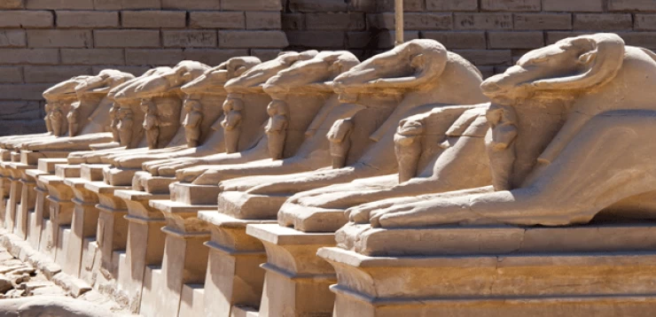
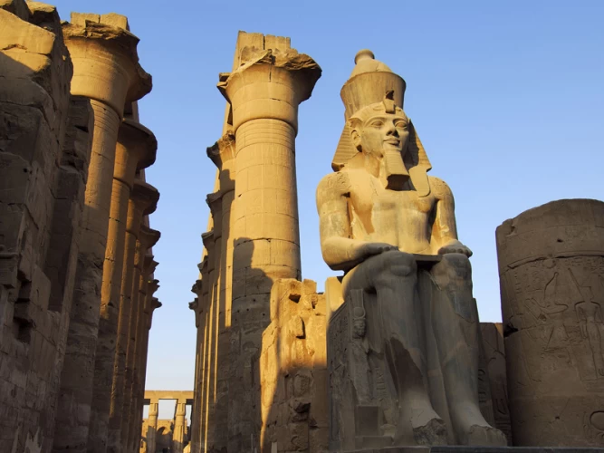
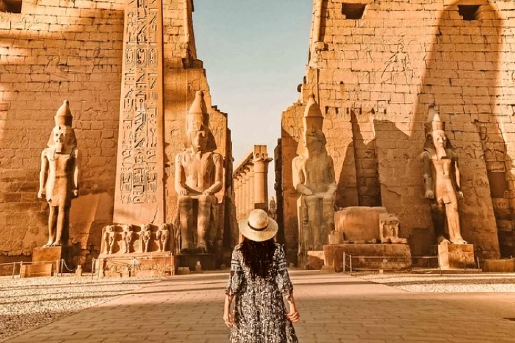
Most of the effects of the governorate are concentrated in the city of Luxor between the eastern mainland, where it was the city of the living, and the western mainland, where it was the city of the dead. The most prominent feature of the city of neighborhoods is the Karnak Temple or Karnak temples in the North and the Luxor Temple in the South, which are connected by the road of rams, which used to represent the god Amun. In the city of the dead there are funerary temples, the most important of which are the temple of Ramses III, and the ramseum temple, erected by Ramses II, and between the two temples a statue of Memnon was erected to amnophis III. The temple of Hatshepsut, erected next to the temple of Mentuhotep, remains a witness to the peculiarity of the architectural design of the ancient Egyptians. As for the tombs, the Kings from the tombs carved in the depths of the valley of the Kings took a safe place for their remains away from the hands of Thieves. As well as the valley of Queens, which embraces some carved tombs of modern state queens and some princes who died at a young age, and among the valleys, senior statesmen chose a few plateaus to carve their tombs in order to remain next to their kings and Queens. Some remains of temples are also scattered in several other cities such as ISNA temple, Tod temple, damod temple.
In 1979, the UNESCO committee decided to include the ancient city of Thebes and its Necropolis on the World Heritage list to carry the number 87, including temples and tombs testifying to one of the oldest civilizations that reached its peak, especially in the middle and modern empires.
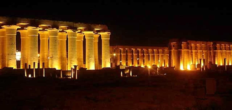
Luxor Temple
The dimensions of the Luxor Temple are 853 feet long and 181 feet at its maximum width, the bulk of the temple dates back to the latter half of the Eighteenth Dynasty during the reign of Amenhotep III "amnophis III" and the first half of the Nineteenth Dynasty during the reign of Ramses II.
The construction of the temple began during the reign of Amenhotep III, whose sitting on the throne was contrary to the ancient Egyptian ruling traditions that required the Pharaoh to be the son of a pharaoh and a princess from a Royal Egyptian dynasty or to marry the eldest daughter of the king, and Amenhotep III did not meet both conditions, as he was the son of a pharaoh, but his mother or wife was not from a Royal Egyptian dynasty, and in order for the new king to strengthen his position on the throne, he claimed to be the son of the God Amon, merged with the god Ra under the name Amon-Ra, and to support his position, he built the temple to satisfy the priests Amon is at the same time increasing his fortunes in the other world.
Fate did not give Amenhotep III until his temple was completed, and his son Amenhotep IV, "amnophis IV", known as Akhenaten, stopped work on the temple, erased the name of Amun from the walls and erected the temple of the new god Aten in the sanctuary of the large building, but after his death, work on the temple was resumed modestly by Tutankhamun, AI, Horemheb and Seti I, until the reign of Ramses II, who added the temple limited extras.
After that era, a number of rulers of Egypt carried out restoration work on the temple, including Alexander the Great, who rebuilt the structure. With the demise of the star of Thebes and the end of the veneration of its temples, Christians established churches inside the temple, and Muslims followed them by erecting the Abu Al-Hajjaj mosque.
Temples of Karnak (entrance)
About a mile and a half from the Luxor Temple, there is a spacious group of sacred buildings known as the Karnak Temples, the heart of which is the Great Temple of Amon-Ra, the largest in Egypt and the world, and it was surpassed in size only by the palaeum granite built by Amenemhat III, but its buildings disappeared and few of its features remain.
The architectural facade of Karnak is a mixture of models through the ages and is therefore considered a historical document of a time period of almost two thousand years starting from the Middle Kingdom 2000 BC.M. And until the era of Ptolemy Xi 80-51 BC.M.
The group of Karnak Temples consists of the Great Temple of Amon-Ra, the temple of Khonsu "the son in the Theban Trinity", the temple of MUT "the wife of Amon-Ra", the temple of Ramses III, the temple of Ptah and Hathor, the temple of Montu.
The architectural history of the Great Temple of Amon-Ra began with the era of Amenhotep I, "amnophis I", who erected the great edifice of the temple, followed by Thutmose I with important additions, built the great courtyard on the north-western side, built the fifth and fourth edifices, erected two obelisks of Red Granite, one of which is still standing, and Thutmose II was also built in Karnak, as well as Hatshepsut, which erected two obelisks, one of which still stands as the tallest obelisk in Egypt and is surpassed in height only by the obelisk of Thutmose III currently standing in Rome.
Then Thutmose III came to surround the two obelisks of Hatshepsut with buildings and built the sixth edifice and the Hall of columns between the sixth and fifth edifices, two obelisks in front of the fourth edifice and a large hall for holidays. During the reign of Amenhotep III "amenhofis III" the road of Rams was built, and the third edifice. While Horemheb erected the ninth and tenth edifices. As for the large lobby of columns, Ramses I began its construction, and after him Seti I built the bulk of it, until Ramses II came to add drawings and sphinxes and claims that he built the whole hall.
Western mainland "funerary temples of Luxor"
The First Temple of SETI in Qurna
It is located on the northern side of the group of temples near the valley of the Kings. Seti I erected it for the funeral service of his father Ramses I, whose short reign prevented him from building a temple for himself, and Ramses II completed the construction after his father's death and allocated it to him jointly with his grandfather Ramses I, in order to acquire for himself the ramseum temple, which his father began building before his death.
The length of the temple from the side of its main axis is 520 feet, but its courtyards have been demolished and only the structure remains with its side chambers, which include columns carved in The Shape of a papyrus Bud, whose current facade and behind it is the wall of Chambers in which doors open to the columns Hall, the Chamber of Ramses II and the compartment of Ramses I. Passing through the main door is the Hall of columns, on each side of which there are three small chambers carved by Seti I.
Hatshepsut temple or maritime monastery
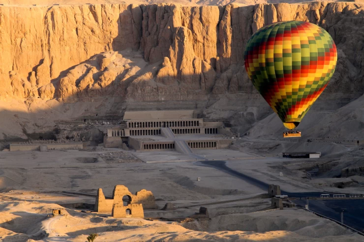
It is one of the most important temples of Egypt and is located behind the group of funerary temples in a gap inside the plateaus at the foot of huge rocks in a semicircular Basin. The name of the maritime monastery dates back to a Christian monastery erected over the temple of Hatshepsut in the seventh century AD. Deir el Bahri is located west of Luxor on the West Bank of the Nile River. A statue of Memnon is located near it on the road between the city of Luxor and it.
Temple of Mentuhotep
The idea of exploiting the great emptiness in the plateaus dates back to two kings of the eleventh dynasty, Mentuhotep II and Mentuhotep III, whose temple, although less luxurious than the temple of Hatshepsut, precedes it by almost seven centuries, as it began to be built around 2200 BC.M. Thus, it is the oldest of the Theban temples that still retain noteworthy remains, and remained in use until the year 1200 BC.M. During the reign of Thutmose III, the temple of Hathor was added to it in the north-western corner. The importance of this temple is due to its combination of the idea of balconies of different height and the idea of a pyramid.
Temple of Hatshepsut
It is the most famous temple in Deir el-Bahri and adjacent to the temple of Mentuhotep, from which the architect of Queen Hatshepsut borrowed the idea of balconies. The Queen built the temple to be a funerary temple for her and her parents, and to dedicate it to Amun next to the other gods Hathor and Anubis as one of the ways to stabilize her position on the throne in light of the turmoil of the early stages of the Eighteenth Dynasty, where she claimed her divine lineage by choosing Amun-Ra to be her father.
Temple of Thutmose III
It is a small temple located between the temple of Hatshepsut and the temple of Mentuhotep, and currently only ruins remain of it. The temple was erected using sand and limestone stones, it had three courtyards.
Ramseum temple
It is the funerary temple of Ramses II, and its construction was started by his father Seti I, and then the son acquired it for himself after he completed its construction, and after him came his grandson mtaftah and then Ramses III to add some secondary buildings that surround the temple on three sides. The area of the temple is 130 thousand square feet, the large eastern edifice forms the entrance to the first courtyard and is currently in a dilapidated state, and to the west side of the courtyard there are the remains of the largest statue of Egyptian statues, the second courtyard is better off than the first, and the hallway leading to the Hall of the great columns is still standing, as well as the Hall of the smaller columns whose roof is still in good condition. The temple of Ramses II is located on the West Bank of the Nile opposite the city of Luxor, which is located east of the Nile.
Temple of Deir el-Medina
The temple is located half a mile west of the ramsium and dates back to the Ptolemaic era. The building is surrounded by a high wall interspersed with a stone door leading to a large courtyard, and there is a Christian monastery in the southern part, the facade is in the form of an arched cornice, and at the end of the temple lobby there are four columns, and on the structures there are drawings of Ptolemy IV "philopater" and Ptolemy VII "pavergate", and views of the process of weighing the heart by the Pharaonic gods.
Funerary temple of Amenhotep III
It is a remnant of the funerary temple of Amenhotep III, "amnophis III", and this temple was demolished as a result of the vandalism of King Merneptah "open" to him after it remained standing for almost a hundred and a half centuries. The temple was erected in memory of Amun, white sandstone was used in its construction, it was decorated with gold, its territory was decorated with silver, and its doors with Electrum. The temple was spacious and decorated with statues carved from granite, the greatest of which are two statues of the king at the entrance to the temple edifice, currently called the statue of Memnon, each rises 64 feet from the bottom of the base to the top of the head, and each is cut from one stone, the upper part of the northern statue fell due to an earthquake that occurred in 27 BC.M. It was restored by Emperor Septimius Severus around 200 AD, and this statue gained wide fame after that because of the sound that comes from its cracked surface at dawn, and it was named Memnon after the Greek legend of Memnon the son of EOS Tithonus, who led the Ethiopians to help the people of Troy when it was besieged and killed by Achilles, it was rumored that the sound of the statue is the voice of the deceased hero saluting his mother EOS.
Temples of the city of Habu
The city of habu is located three-quarters of a mile south of the statue of Memnon, a group of funerary temples stretching along the eastern side of the Theban Necropolis. The oldest and smallest of these temples is the funerary temple of Amenhotep I, "amnophis I", which was raped by Thutmose I, and then some buildings were added to it during the reign of Hatshepsut and Thutmose III, and Ramses II and III also built in the temple, and the works of the Ptolemies and Romans are the last works that were erected in it. The sanctuary of the city of Habu was surrounded by a wall of Adobe clay, and in front of it on the West Side a stone wall with a gate, after bypassing it, there is the gate of Ramses III, known as the high gate, which was originally constructed as an Egyptian image of the Syrian Castle of majdul, which was attacked by the king in his conquests, and to the left of it is the temple of amnerdis, the daughter of the Ethiopian ruler King Kashta and the wife of bayankhi II.the temple consists of a chamber with four columns that reaches a domed structure surrounded by a passage, and the remaining relic in a good state of preservation is the temple of Ramses III.
Temple of Ramses III
It is one of the large temples of the modern state that still remains in a reasonable state of preservation, and it is of great height. In the two facades of its towers there are gaps for placing flags, on the south side of the first courtyard there is a row of round columns, and on the north side another row of square columns. The second edifice of the temple serves as the back wall of the first courtyard, and the second courtyard has two systems of columns, on the North and South Sides a row of five round columns, and on the East and West Sides a row of eight ozorian columns.
Small temples
Between the temple of Thutmose III and the ramseum there is a temple of King sebtah, another temple of Amenhotep II "amnophis II", and the White Queen's cabin belonging to a princess or queen. To the south of the outer wall of the ramseum is a demolished temple of Prince wasmosi, son of Thutmose I, and to the south of it are the remains of the mortuary temple of Thutmose IV, father of Amenhotep III "amnophis III", and under the outer wall of this temple there is a small cabin of Khonsu artais, and to the South more are the foundations of the temple of Queen tosert, daughter of mtaftah, and to the south are the few remains of the mortuary temple of "Merneptah" son of Ramses II. And 4 km south of the temple of the city of Habu, located in the south of Mount Memnon, west of Luxor, is a Roman temple known as Deir shalwit or the small temple of ISIS and was dedicated to ISIS, the goddess of motherhood and childhood among the ancient Egyptians.
Tombs of the nobility
Thutmose I was the first to take for himself a tomb in the valley of the Kings, which was among the first group of tombs that followed him later and which represent the general rule in the Valley. The tomb is not visible in terms of external appearance and entrance, unlike the late tombs, where the Pharaohs of the Twentieth Dynasty paid attention to the luxury of the entrance, internal inscriptions and huge coffins when they realized that hiding tombs is not the way to preserve them. The royal tombs located in the Valley date back to the reign of the eighteenth, nineteenth and Twentieth dynasties, and burials there ceased after that. As the plans to hide the tombs failed one by one, the riches attached to the tombs were looted by grave robbers throughout the ages. Several tombs have been discovered in the valley of such great kings as Horemheb, sebtah, Thutmose III, Amenhotep III, Hatshepsut, Seti I, Merneptah "open", Ramses II. However, the most important discovery in the valley or perhaps in the history of modern archeology is the contents of the Tomb of the young pharaoh Tutankhamun by Howard Carter on November 4, 1922 and the burial chamber was opened on November 16, 1923. It is considered the only tomb of the Pharaohs that was not stolen by robbers.
Valley of the Queens
The tombs of the queens are located at the southern end of the Theban Necropolis.the custom of burial in that area began during the reign of Ramses I of the Nineteenth Dynasty, who buried his wife set-Ra there. his grandson Ramses II followed suit, where his wife Nefertari was buried. during the reign of Ramses III, his wife Isis was buried in the Valley, and the families of Kings from the Twentieth Dynasty were also buried in the area, after which the valley was abandoned as a royal residence.
The tombs of the nobles are a "good coward"
These are the tombs of the aristocracy and the court circles of the good glory days, on the walls of which they recorded the scenes of business and the pleasures of worldly life, which it was believed that the deceased could restore by magic in the afterlife. These tombs were carved into the rock and other materials such as mud and limestone were used in their construction to avoid defects in the rock. Thebes cheese stretches for about two miles from the road leading to the valley of the Kings in the north to the city of Habu in the south, almost three miles from the Nile River, and behind it a line of hills rises on a high point in the form of a pyramid known as the horn, from which the name of the most famous part of the cheese known as the corn is derived.
Other temples in the province
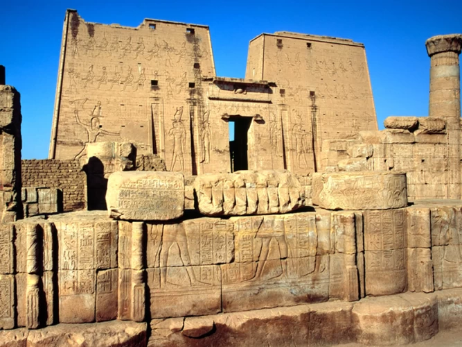
Esna Temple "Temple of Khnum"
The construction of the temple began during the reign of the Ptolemaic King philometor, and was added in the Roman era to the Hall of two bishops dating back to the era of the Roman Emperor Claudius, and completed the decoration and decorative works of his successors from the emperors, and the temple was discovered in the late era of Muhammad Ali Pasha in 1843, where it was used as a gunpowder storage.
The temple is located on the West Bank of the Nile River, about 100 m from the river, vertically perpendicular to it on one axis, and its floor drops about 9 m deep from the modern ground level of the city of Esna.
The temple was dedicated to the worship of one of the ancient Egyptian gods known as "Khnum" the proud God or the creator of humans from clay. The temple consists of a rectangular hall with a width of 108 feet and a depth of 54 feet, with an intact roof supported by six rows of huge columns, each row of which consists of four columns, each 37 feet long and 17.75 feet in circumference, while the width of the facade is 120 feet and a height of 50 feet.
Temple of Tod "Temple of Montu"
It is a temple dating back to the Ptolemaic era, built on ruins dating back to the Fifth Dynasty, where the city was one of the areas of worship of Montu, the God of war in ancient Egypt during the Middle Kingdom.
The remains of the temple indicate that parts of it belong to the eras of both Mentuhotep and Senusret I, and other remains to an older period of the reign of King userkaf of the Fifth Dynasty, along with some additions from the New Kingdom and later eras, including a cabin built by King Thutmose III.
Temple of Madame "Temple of Montu"
It is the remains of a temple dating back to the Ptolemaic era located in the village of Al-madamud belonging to the center of zeitya and built on the ruins of a temple that was dedicated to the worship of "Montu" the God of war among the ancient Egyptians during the Middle Kingdom, where remains dating back to the reign of King Senusret III were found.
In the era of the New Kingdom, during the reign of the Eighteenth Dynasty, a new temple was built in the style of official temples consisting of a edifice and an open courtyard, and then the covered courtyard up to the Holy of Holies, and in the Ptolemaic era, extensive and large additions were made to the temple using stones and Gates dating back to the Middle Kingdom era.
Islamic monuments and archaeological buildings.
The ancient mosque: the history of the construction of the ancient mosque in ISNA dates back to the Fatimid era, but it was renovated several times and only the minaret, located in the tribal corner of the western facade of the mosque, remains of its ancient features. Its base underwent only some changes during the architecture carried out in 1295 Ah.
On the base of the minaret of the mosque there is a sundial from the work of Khalil Efendi Ibrahim, the engineer of the astronomical map in 1287 Ah. The old mosque was founded by the Emir of armies Saif al-Islam Nasir Imam Abu al-Najm Badr al-Mustansir in 469 ah and the roof in 470 ah and the minaret was established in 474 Ah.
Al-Omari Mosque: the al-Omari Mosque is located in the village of isfun, ISNA, and its foundation dates back to the Fatimid era, but it was followed by reform and renovation until only the minaret, which is very similar to the minaret of the ancient mosque, remained of its ancient features.
The House of Khwaja Steen Gibran: the House of Khwaja Steen Gibran was built in ISNA in 1790 and renovated in 1890 and consists of a courtyard in the middle of the house and a Divan for men on the upper floor, topped by the Divan for the harem and used in its construction of the bricks.
Al-Jeddawi monuments: these are the buildings of the Emir of Major General Hassan Bey Ali al-Jeddawi in ISNA, which is represented by Khan al-Jeddawi, which was established in 1211 ah and the dome of Al-Jeddawi, which was established in 1207 ah and attached to the Diwan Chapel consisting of two opposite Iwan.
Khan al-shanqara: it is one of the old trading shops in ISNA and is located near the ancient mosque and was established by Mr. Abdul Rahim Abdul Bari shanqbar in 1264 Ah.
Jabakhana: it is one of the ancient military fortifications in ISNA, which dates back to the era of Muhammad Ali Pasha and was built of stone in the form of forts with towers.
Ramadan cannon: it is an antique cannon of the English Krupp brand located in the Awamiya area of Luxor, dating back to 1871, where it was used to alert fasting people about the time of iftar during Ramadan.
Coptic monuments
Deir Al-Shayeb: Deir Al-Shayeb, Deir bakhum or Deir Anba pakhomius is one of the monasteries of St. Anba pakhomius, located 4 km from Luxor airport and 10 km from Luxor city in the north-eastern direction. The monastery consists of an archaeological church dating back to the XVII-XVIII centuries AD and consists of 6 structures in a row. The monastery was known as Deir Al-Shayeb because it is a common word in Egypt for sheikhs with Shaybah, and its construction dates back to the fourth century AD by Queen Helena, the mother of Emperor Constantine.
Martyrs monastery: located 5 km from the city of ISNA, it is built of bricks and has shallow domes, and the most important part of it is the structure of Anba armenius, in front of which is a small dome resembling Fatimid domes.
Al-Fakhouri monastery: it is located 8 km from the village of isfun, ISNA, and its establishment dates back to the fourth century AD. The monastery is divided into several buildings, the Caesarea, a brick building dating back to the Fatimid era, a church with a dome in the middle, and the palace, which is located in the northern corner of the monastery, a square-shaped building.
The monastery of the Saints: it is the monastery of the martyrs Anba Bishai and Anba Peter and is located east of the village of Tod. The Old Church has four structures in a row dating back to the sixteenth and seventeenth centuries and the newer church has three structures dating back to the eighteenth and nineteenth centuries.
Museums
Luxor Museum
The Luxor Museum is located near the Nile Corniche, and its opening date dates back to December 16, 1975, at the hands of Egyptian President Mohamed Anwar Sadat with his guest, the French President, Valery Giscard d'estaing. In 1984, the first and largest development of the museum took place with the establishment of an indoor exhibition in the Old Exhibition Place, and in 1992 the hidden Hall was opened, while the last development was the second expansion of the museum through the establishment of the glory of Thebes Hall in 2004. The museum includes more than 376 rare artifacts representing the Pharaonic history in several eras, and it consists of two floors, ground and upper, the ground of which contains a number of artifacts, the most important of which are the statue of Amenhotep III, the statue of Thutmose III and the Karnak painting, while the second floor contains a number of statues, the most important of which is the statue of Akhenaten, and a number of Coptic funerary paintings, and the museum also includes a large hall where the hidden statues discovered on January 22, 1989 the museum has ancient Egyptian tools used in architecture and engineering, and a collection of mummies.
Taxidermy museum
The "mummification museum" is located north of the Luxor Temple on the Nile Corniche and was opened in 1997 with the aim of highlighting the techniques of ancient pharaonic mummification art applied by the ancient Egyptians. The museum includes a large number of mummies of kings, princes, cats, fish, crocodiles, and all the ancient pharaonic means and tools that were used in embalming works. The exhibits are represented by more than 150 ancient pharaonic objects, along with views simulating the papyri "honifer" and"Annie", which date back to 1200 BC.M. The original is housed in the British Museum. The museum occupies an area of 2035 square meters and contains an exhibition hall with ten hanging paintings showing the details of the funeral procession rituals and procedures followed from death to burial, 19 glass display windows, a lecture hall and a video explanation room, and the exhibits of the mummification museum are centered on 11 basic topics (ancient Egyptian gods, mummification materials, organic materials, mummification fluids, means used in the mummification process, canonical my magicians, stuffed animals).
Howard Carter Museum
In 2009, the Supreme Council of Antiquities decided to restore and revive the house where the British archaeologist Howard Carter "the discoverer of Tutankhamun's tomb in 1922" was staying and turn it into a museum open to visitors, in recognition of his outstanding contribution to Egyptology. The house was built in a traditional country style of adobe bricks and displays the tools that Carter used to dig and excavate, next to his furniture and a collection of photographs of him during the work.
Irrigation Museum
The Esna irrigation museum was opened in December 2012 and consists of one floor constructed in the style of modern architecture on a flat area of about 600 m2. It is located on the Left Bank of the Nile River at the new Esna aqueducts. The museum displays models of irrigation projects and power plants attached to them in the tribal face, such as: the model of the new Esna aqueducts, the model of the new Nag Hammadi aqueducts, the model of electricity generation from the Aswan reservoir, the model of the gravity tower to generate electric power.
Tank reserve
Al-dababiya was declared a geological nature reserve in accordance with Prime Minister's Decision No. 109 of 2007 to declare the international standard sector in the AL-dababiya area as a Nature Reserve No. 27 within the framework of Law No. 102 of 1982 on nature reserves. Mesozoic and the beginning of the spread of secretive and placental mammals such as rodents, herbivores, primates, carnivores, reptiles, whales and sea cows appear in the Reserve. The Tank Village was adopted by the International Union of geological sciences as the first geological time unit outside Europe since the origin of the science of geology.
Culture
Luxor Public Library "Luxor Cultural Center"
Luxor was chosen as the capital of Arab culture in 2017 by the Arab educational, cultural and scientific organization of the league of Arab states for the integration of pharaonic, Coptic and Islamic civilizations.
Luxor, with its history spanning several eras, has inspired many writers to write valuable literary works, most notably Najib Mahfouz's novel The Good Fight. And the novel Death Over the Nile by Agatha Christie.
The cultural centers of the governorate, represented by the palaces of culture, the youth City, the Luxor Public Library" Luxor Cultural Center " sponsor folk arts, cultural events and seminars in the governorate،
Architecture
In addition to the ancient urban styles of archaeological sites, modern urban styles vary in the governorate in different cities and villages, there are areas with high aesthetic and economic values, such as the Corniche Road with its tourist facilities.
In New Taiba, the construction of residential units and modern buildings continues on a pre-prepared system and plan.
As for the new Qurna, it is located in the rural village designed and built by architect Hassan Fathi with its domed and basement buildings, and its unique architectural style, which harnessed the natural materials surrounding the place from silt and limestone in the construction, to combine interaction and integration with the environment, artistic beauty and cost-saving.
And at the Luxor train station, the formal elements inspired by the Pharaonic style appear. The influence of old classical designs can be traced in the old hotels built in the Victorian style and in residential buildings on major commercial streets such as Station Street and the tourist market.
While a large segment of the population turned to random construction using red brick and concrete in several areas due to the sustainability of construction and the low cost of its maintenance compared to Adobe and limestone buildings.
Exhibitions, conferences and festivals
The governorate has witnessed the organization of several international and regional exhibitions and festivals such as the Luxor International Book Fair, the documentation house exhibition, the Luxor festival of African cinema, the Luxor festival of Egyptian and European cinema, the Luxor festival of Arabic poetry, the international cultural Drumming Festival, the Arts Festival, the Nefertiti International Festival of fashion and culture, the Camel Festival and Camel Races, The International Carnival of drums and folk arts, the carnival of excellence and creativity, the International Conference of plastic arts and community service, the international forum of graphic arts.
Public information
Luxor was chosen as a filming location for several Egyptian and foreign works of art, including The Mummy films, conflict in the Valley, love in Karnak, conflict in the Nile, the search for Tutankhamun, a hero from Upper Egypt, Askar in the camp, Valley of the Kings, death over the Nile "based on the novel of the same name", the documentary film "The Story of God", the valley of the Kings series, The Sunset Oasis series.
Economy
Tourism
Tourism is the backbone of the governorate's economy due to its cultural, historical and archaeological heritage, and infrastructure that strongly supports this activity, on which a large percentage of the governorate's population depends as a source of income. The governorate accounts for a large proportion of the tourism numbers coming to Egypt. In 2010 the project of transforming the city of Luxor, the capital of the governorate, into the largest open-air museum was started and it is also a member of the organization of Islamic capitals and cities. In 2016, the Executive Board of the United Nations World Tourism Organization selected it as the world tourism capital for 2016, in addition to hosting the organization's meetings at the end of October 2016.
One of the popular tourist activities in Luxor is the "flying balloon" hot air balloon tours, which ascends tourists at an early hour of the morning at an altitude of 2000 feet, allowing them to enjoy watching the monuments of Luxor and the sunrise amid the clouds. The balloon can accommodate from 12 to 34 people, the duration of the flight varies from 40 to 60 Minutes.
Agriculture
In 2011, the total cultivated area in the governorate amounted to 144,733 acres, including 131,779 acres for field and vegetable crops, and 12,853 acres for gardens. The most important crops currently grown in the province are sugar cane on an area of 65,000 acres, wheat on an area of 48,000 acres, tomatoes on an area of 12,000 acres, Levantine corn on an area of 6,000 acres, bananas on an area of 6,500 acres. As for export crops, the province is characterized by the cultivation of grapes, cantaloupe, green beans.
Industry
The first industrial zone in the governorate is located south of the new city of Thebes on an area of 382.71 acres, which is dedicated to light and agricultural industries.the area is characterized by its proximity to the infrastructure of the new city of Thebes. it is about 10 km from Luxor International Airport, about 210 km from Safaga Seaport on the Red Sea, and 5 km from the nearest railway line, and near it is Luxor/Qena/Safaga East Road.
Handicrafts
The Nubian Cultural Center sponsors handicrafts and arts for the Nubian people who migrated to Luxor from Aswan. The urban center for women conducts training on handicraft projects and heritage handicrafts that are suitable for tourism marketing. Among the handicrafts spread in the governorate are alabaster carving, copper engraving, Wicker and braid, scrapbooking carpets, handmade carpets, hand-woven "Furka", kilim, khayamiya, ceramics and pottery, embroidery and sewing.
Education
There are 906 schools spread across the cities and villages of the governorate, covering all stages of pre-university education and involving more than 260 thousand students, including public and private schools, special education schools and community education. This is in contrast to the Azhari educational institutes, which are attended by more than 31 thousand students at various educational stages. As for higher education, the governorate is home to the branch of South Valley State University, which currently includes 7 faculties: tourism and hotels, fine arts, Antiquities, languages, computers and information, medicine, nursing. This is in addition to private facilities such as the Higher Institute of engineering and technology in toud and the higher hotel Institute in Luxor.
Health
The health sector in the governorate varies between University, Public, central, and international teaching hospitals, including Karnak International Hospital, Luxor University Hospital, ISIS specialized hospital for women and childbirth, Qurna Central Hospital, Horus specialized hospital, Thebes specialized hospital, Qurna Central Hospital, Bayadiya Central Hospital, Luxor International hospital, Shifa Al-Orman hospital, and Al-adisat specialized children's hospital.
Sports
Luxor has a sports infrastructure that has qualified it to organize several regional and international tournaments, including the Luxor International Taekwondo Championship, the Luxor International Marathon, the Billiards World Cup championship, the African Cycling Championship, the Egypt international championship of sports navigation, the championship of the first Nile rowing, kayak and canoe festival, the African and African International Open bow and arrow championships. There are 87 youth centers in the governorate, in addition to sports clubs, which number up to fifteen clubs, the most famous of which are Luxor Sports Club, Medina club, and Al-musawiya Sports Club.
Hotels, restaurants, shopping centers
Since the tourism sector is the backbone of the Luxor governorate's economy, it was necessary for the tourism infrastructure to be able to receive the numbers of domestic and foreign tourists.
Luxor owns a large number of fixed and floating hotels that operate between Luxor and Aswan, the most famous of those hotels are Sonesta, Nile Palace, Ashti resort "Sheraton", Jolly Ville, Steigenberger, Hilton, Winter Palace "Winter Palace", softell Mercure.
The "Winter Palace" Hotel, located near the Luxor Temple, is one of the oldest buildings in the governorate, dating back to 1866.
The diversity of tourist delegations coming to Luxor is also reflected in the diversity of its restaurants offering traditional local cuisine and foreign cuisine that suits several different nationalities. As for shopping centers, the most famous are the bazaars of the Old Market, which imitate Khan el-Khalili in Cairo, and the bazaars of the tourist street in Esna, next to modern shopping malls.
Transportation
Works on the development of the old Luxor airport began in 1984 and opened in 2005 at a cost of 450 million pounds. The development works included the passenger terminal, corridors, service buildings, information and security systems equipment, database systems, baggage monitoring and tracking, modernization and replacement of the main corridor and auxiliary corridor lighting system, development of the electrical supply network. The airport's capacity increased from 800 passengers per hour to 4,000 passengers per hour with a total of 7.5 million passengers per year, and from 21 aircraft to 33 aircraft after the construction of a new terminal accommodating 12 aircraft of different models. The new passenger terminal consists of three levels with a total area of 55 thousand meters, which includes loading areas for travel belts, arrival with a surface of 5000 meters, two arrival halls for international travel, two travel halls and local arrival with a total of 48 "counters", in addition to a shopping center including four cafeterias, two duty-free markets, a children's play area and major restaurants.
River transport
The river transport sector is one of the most important elements of the transport system within Luxor with all its elements, whether shipping lines, Nile marinas, navigational mansions, navigation infrastructure, which serve tourist floats operating between Luxor and Aswan, as well as transport barges, sailboats and ferries. The Cairo/Aswan shipping line passes over the Luxor Nile marinas and this line is used for the transport of goods and passengers and allows the double passage of river units.
Nile anchors
Nile marinas in the governorate provide tourist floats with all their special needs, including electricity, sanitation, fresh water, and others, and one of the most famous of these marinas is the Ministry of Tourism Marina, whose facade length reaches 8.2 km.
New Esna aqueducts
The ancient Esna aqueducts were built during the reign of the Khedive Abbas Hilmi II in 1908 at the 169th kilometer on the Nile River to control the flow of water during the flood period, improve navigation downstream and ensure the continuity of irrigation of the isfun and kalabiya pastures. While the new Esna aqueducts were built in 1994 behind the old ones around 1200 AD, in order to provide the necessary water to meet the growing needs for irrigation, as well as the generation of electric power, as well as the development of river navigation by creating a HOYS that allows the passage of two large navigation units at the same time, and increasing the load on the road connecting the two banks of the Nile to 70 tons instead of 20 tons.
The railway
Egypt was the second country in the world to be entered by Railway trains after Britain, where the railway era began around 1850. The idea of the project was aimed at connecting the red and Mediterranean seas by land to facilitate the transportation of goods, before the Suez Canal excavation project, work began on the project in 1852 and the first stage of it was completed from Cairo to Kafr El Zayat in 1854, after which the construction of the line was completed to Alexandria, and then from Cairo to Suez.
During the reign of the Khedive Ismail the lines stretched up to 1200 miles. In 1898, the train arrived in Luxor, and with the fall of Egypt under British occupation, a private company called Qena/Aswan Railways was established, owned by British investors, which took over the extension of the railway line to the city of Aswan and used in that part a different type of rails and trains forced the trains of the Egyptian Railways heading to Aswan to stop at Luxor station and disembark passengers to take another train operated by the British private company.
Land routes
Luxor is connected to the rest of the cities and governorates of Egypt by several land axes, the northern axes begin to connect with the nearest governorates to Luxor, which is Qena, and from Qena the axes branch off, it can be connected East with Qena/Safaga road to reach the Red Sea, and from Safaga to Hurghada, or North with Qena/Sohag road, then Sohag/Assiut road, Assiut/Cairo Road, and the northern axes pass the same stations or cities on the eastern desert level road, the western desert level road, the agricultural level road, the creams road, and in the south, the eastern and Western axes of the upper level are used to connect with Aswan.
Latest Articles
Admin
Regin of Abbas I of Egypt | Abbas Pasha I
Abbas has been often described as a mere voluptuary, but Nubar Pasha spoke of him as a true gentleman of the "old school". He was seen as reactionary, morose and taciturn, and spent nearly all his time in his palace. He undid, as far as lay in his power, the works of his grandfather, both good and bad.
Admin
Biography of Tewfik Pasha/ Tawfiq of Egypt
Muḥammad Tawfīq Pasha (born April 30, 1852, Cairo, Egypt—died Jan. 7, 1892, Ḥulwān) was the khedive of Egypt (1879–92) during the first phase of the British occupation. The eldest son of Khedive Ismāʿīl, Tawfīq, was distinguished from other members of his family by having engaged in study in Egypt rather than in Europe
Admin
Story of Gabal Shayeb Al Banat - Red Sea Mountain
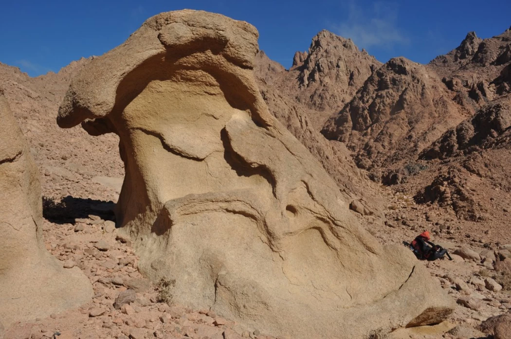
Jabal shayb al-banat is one of the Red Sea Mountains in the eastern desert in Egypt, located to the west of the city of Hurghada at a latitude of 27 degrees north and a longitude of 33.5 degrees east of the Greenwich line approximately, this mountain is the highest mountain peak in the eastern desert with a height of up to 2185 meters, it is a prominent mass of igneous rocks
Admin
Neper God Of Grain
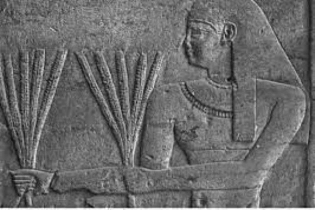
Neper was the deity of grains, particularly cereals that were important in Ancient Egypt, such as wheat and barley. It was stated that he foretold when the crops would grow, be harvested, and disappear.
Admin
Badr Museum in Farafra
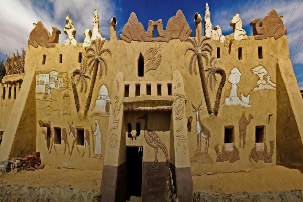
The Badr Museum is located in a mud building, which is the common home found in this medieval part of Egypt. All of the artwork that was created by the artist is quite unique. His work almost always depicts life in the Farafra Oasis and he provides the work through both painting and sculpting.
Admin
The Black Head Temple
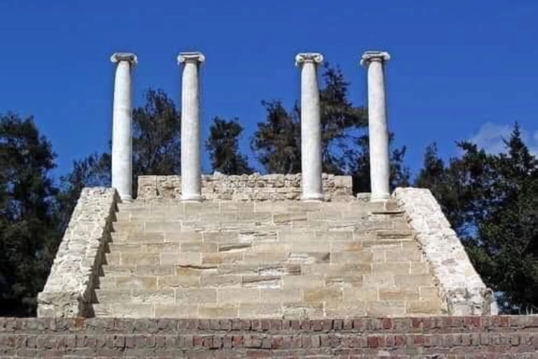
The Black Head Temple is a small temple dedicated to the worship of the goddess Isis and was discovered in 1936, by chance, in the Black Head area, which is now located within the Mandara area of the Montazah district in Alexandria. This temple was moved from its original place to the Latin Necropolis in 1994.
-webp.webp)
